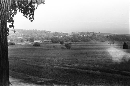
Nemesszentandrás, Zala, A község látképe
| Collection | Göcseji Múzeum gyűjteményei |
| Inventory number | 4027 |
| Title | A község látképe |
| Author | Dr. Szentmihályi Imre |
| Type | Fotó |
| Description | Északnyugatról. A község dombon van, a házak gyümölcsfák között. |
| Date | 1964.07.20 |
| Place |
Nemesszentandrás
Zala |
| Keywords | Néprajzi fotótár; Néprajz; Földrajz; |
| Other fields |
Méret: 2,4 × 3,6 és 6 × 9 cm |
| Automatic keywords | templomtorony; steeple; építészet; architecture; természet; nature; szabadban; outdoors; mező, pálya; field; vidék; countryside; menedék; shelter; épület; building; vidéki; rural; legelő; grassland; farm; farm; talaj; ground; növény; plant; fa; tree; föld; land; torony; tower; templomtorony; spire; legelő; pasture; tájkép; landscape; rét; meadow; táj, látvány; scenery; tanya; ranch; út; road; légi felvétel; aerial view; |
| Images |
|
No user provided keywords
No comments