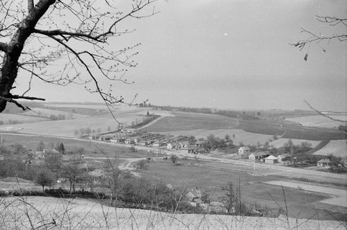
Hottó, II. ker., Zala, A község látképe
| Collection | Göcseji Múzeum gyűjteményei |
| Inventory number | 4537 |
| Title | A község látképe |
| Author | Dr. Szentmihályi Imre |
| Type | Fotó |
| Description | A Hottóhoz tartozó volt Zalaszentmihályfa délről, a szőlőhegyről tekitntve. A háttérben (fák között) Hottó látható. |
| Date | 1965.04 |
| Place |
Hottó, II. ker.
Zala |
| Keywords | Néprajzi fotótár; Néprajz; |
| Other fields |
Méret: 2,4 × 3,6 és 6 × 9 cm |
| Automatic keywords | természet; nature; szabadban; outdoors; fa; tree; növény; plant; vidék; countryside; épület; building; vidéki; rural; madár; bird; állat; animal; föld; land; mező, pálya; field; legelő; grassland; városi; urban; fenyő; abies; fenyő; fir; farm; farm; növényzet; vegetation; menedék; shelter; udvar; yard; táj, látvány; scenery; repülőtér; airfield; repülőtér; airport; tájkép; landscape; |
| Images |

|
No user provided keywords
No comments