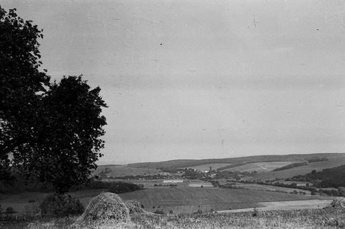
Bezeréd, Zala, A község látképe
| Collection | Göcseji Múzeum gyűjteményei |
| Inventory number | 5215 |
| Title | A község látképe |
| Author | Dr. Szentmihályi Imre |
| Type | Fotó |
| Description | Nyugatról, az orbányosfai Báni-hegyről nézve. |
| Date | 1966.05 |
| Place |
Bezeréd
Zala |
| Keywords | Néprajzi fotótár; Néprajz; |
| Other fields |
Méret: 2,4 x 3,6 és 6 x 9 cm |
| Automatic keywords | természet; nature; szabadban; outdoors; vidék; countryside; mező, pálya; field; legelő; grassland; vidéki; rural; talaj; ground; épület; building; növény; plant; fa; tree; farm; farm; föld; land; tájkép; landscape; legelő; pasture; torony; tower; építészet; architecture; domb; mound; menedék; shelter; út; road; rét; meadow; szavanna; savanna; tanya; ranch; |
| Images |
|
No user provided keywords
No comments